山区孕灾环境下地震和极端天气气候对地质灾害的影响
史培军1,2,3( ), 杨文涛4
), 杨文涛4
Compound effects of earthquakes and extreme weathers on geo-hazards in mountains
SHI Pei-Jun1,2,3(), YANG Wen-Tao4
), YANG Wen-Tao4
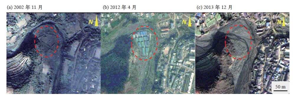
图1. 汶川地震后重建的平武县建全村被发生于2013年8月的泥石流摧毁,地震前2002年11月的卫星影像(a),地震4年后的卫星影像(b),泥石流后的卫星影像(c)
注:所有影像来自Google Earth,研究区位于32°14′57.8′′N,104°53′8.7′′E。
Fig. 1. The post-seismic newly built buildings in Jianquan village, Pingwu, were destroyed by a debris flow in August 2013, pre-seismic 1 m resolution IKONOS image (a), 0.5 m WorldView-01 image in 2012 (b) (4 years after the earthquake),1 m IKONOS image after the debris flow (c)